Niton. Ghosts of the Isle of Wight, with Margo Williams

Ghosts of Niton Undercliff
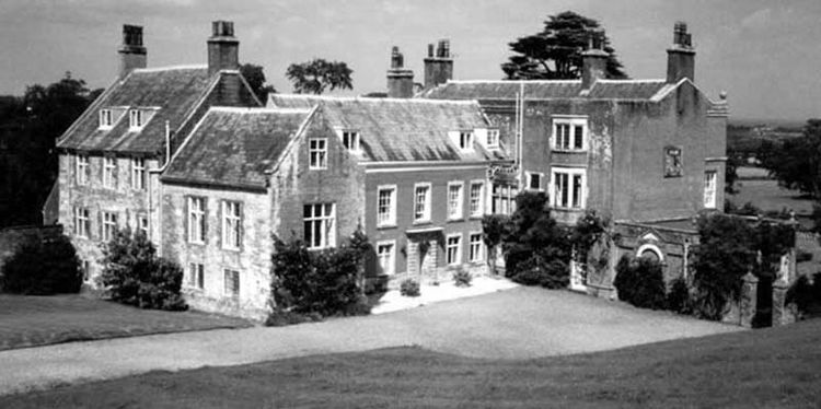
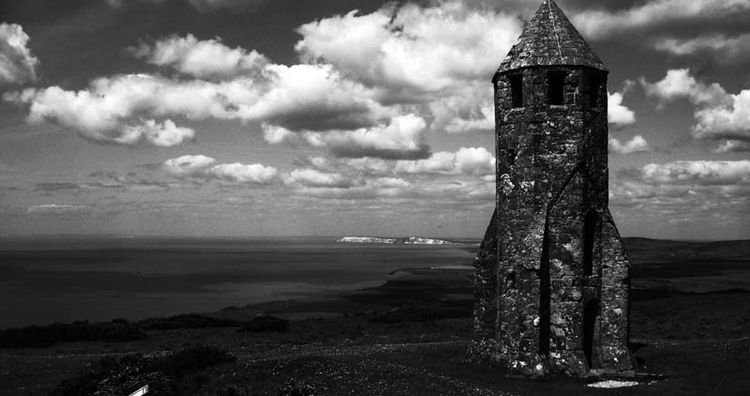
People mostly assume ghosts haunt historic buildings, like St. Catherine's light tower; Appuldurcombe House or the fabulous Buddle Inn in Niton but sometimes ghosts happen in ordinary homes. Even new-built bungalows in the Undercliff region.
The Undercliff is a spectacular world to haunt, magnificent villas and houses chance their survival in the notoriously unstable ground of "Landslip". A splendid gamble for many though some, including the famous Sandrock Hotel, crumbled.
The Smuggler's Legacy
In Niton's fabulous Buddle Inn, on stormy nights, talk turns from Undercliff ghosts to smuggling. In the warm glow of crackling fires and fine aged cognac, salty local seafarers raise a glass to their distant parents who from childhood learned the sea currents and how to catch the winds.
Who breezed across to the French coast and returned with brandy and tobacco; hid that contraband from excise patrols in hidden cracks and crevices caused by the Undercliff's odd environment. Or secret bunkers carved under grand Undercliff houses; and supplied the Buddle Inn's regulars with top quality refreshment.

Sometimes on stormy winter nights a bar-person animates the descendants of those regulars with a question - is the Isle of Wight the fabled Isle of Ictis?
The Mystery of Ictis
A reference and description of an island named Ictis was made by Diodorus Siculus, a Greek historian who lived in the late first century BC. His Bibliotecha Historica makes note of an island in the north named Ictis to where the British Celts transported tin to a depot port on that "near at hand island" where it was embarked for sea carriage to the continent.
Diodorus' description of transportation of tin from Cornwall via Ictis to the coast of France has been a point of debate. A fanciful notion dreamed up during the Elizabethan era that dates back to a 1000 BC when Phoenicians traded for tin with the ancient Britons; and residents of Niton Undercliff offered a safer import export alternative direct to Normandy for onward overland transportation of this valuable Bronze-Age commodity, safe from coastal pirates and this side of deadly Blackgang Chine.

Overland was the safest option. Enemy navies controlled the ocean; Phoenicians persuaded the Britons to bring their tin to the nearest and safest place of transit to the coast of France, which was obviously the Isle of Wight.
Most objections to the Isle of Wight Ictis connection is preference for Cornwall's St. Michael's Mount.
'There is abundant proof,' says island historian Adams, 'that St Michael's Mount did not exist as an island in those days but was 'part and parcel' of the main land of Cornwall. Adams provides evidence of his proof in his essential guide: History, Topography and Antiquities of the Isle of Wight.
Niton's Smugglers' Legacy
Archaeological work confirms a greater quantity of Bronze-age burial mounds on the Isle of Wight, compared to the subsequent Iron-age period. This suggests the Isle of Wight was densely-populated during this period.
So, chances are some Island merchants did think it worth the effort. Of Britain's notorious smuggling areas, Cornwall and the south coast of the Isle of Wight are the most famous. Is this simply coincidence? or the vestiges of highly skilled import and export communities preserved by natural geography and isolation?
Diodorus' description of transportation of tin from Cornwall via Ictis to the coast of France has been a point of debate, but Adams believed the evidence pointed to the Isle of Wight as Ictis. Not the Scilly Isles, or St. Nicholas Isle in Devon.

Diodorus' description does fit the Isle of Wight. However, the greatest clue to the identity of Diodorus' mystery tin island, says Adams is its name - 'Ictis' which is remarkably close to the Roman name for the Isle of Wight - 'Vectis'
"...By placing the Digamma (the v) before this word it becomes by a not uncommon orthographical change the Vectis of the Romans, as we find the Greek word (is) force, is changed into the Latin Vis."
The Niton Depot and Puckaster Port
Two ancient British roads, named by Romans as Chillerton Street and Chale Street led to a depot at Niton, Adams continues; and somewhere here '...was the tin market where merchants drew up their carts and arranged sales with foreign purchasers.'
Below Niton is Puckaster Cove, and people have often wondered how it got this strange name. Romantics think of 'Puck' and fairies as a source; but folklore investigator Adrian Searle reminds us how Chinese-whisper close it is to the Latin 'pudica castra' or 'impregnable camp'.
So, was Puckaster port, with its great fortress, the place where the tin was loaded on ship? Although now you might not think it much with all the modern coastal defences in place, two thousand years ago it was a port big enough for purpose, and probably big enough to harbour a Roman fleet, concludes Adams who points across the Channel to where the route continues. And where the ferries to this day come and go.
The Greek and the Geeks
Ultimately, if the question is whether Vectis is the lost Isle of Ictis; the answer depends how far 'close at hand' is to a Greek 2000 years ago and 2000 kilometers away.
Before the subject of smuggling returns to ghosts and haunted Niton houses, the barkeep sometimes offers an even deeper layer to the old tin route theory.

Stone Age Superhighway
It is a very old highway, look at a map.
Before compasses, ships followed coastlines, carrying highly valuable tin product cargos around the Iberian peninsular, through the Bay of Biscay was much more dangerous due to bad weather and pirates. The safest route was overland from Marseilles to the Normandy coast. Marseilles was the international port to the north African continent.
Same applied to the route from Normandy to the Cornish tin mines. Better by far to transport tin product overland to the closest port - Niton on the Isle of Wight.
Stonehenge is dated to about the time of the Giza pyramids; so to the meglaithic Longstone dolmen at Mottistone on the Isle of Wight. Coincidence?
"The question is," says the cognac-sweetened barfly in the Buddle Inn - "If you were an astronomer priest based at the Great Pyramids project in Giza and wanted to travel to the northern observatory site at Stonehenge in Wiltshire, which route would you take? Around the coast, or direct?"
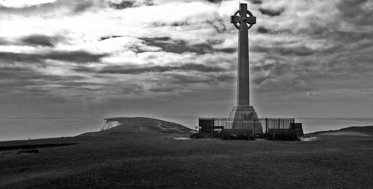
Chances are, your arrival in Britain would be welcome-lit by a light tower high above Niton, say St. Catherine's Down, warning of the dangerous Bay of Death. You might disembark in Puckaster port and grab a drink and a bite to eat in the fabulous Buddle Inn, or whatever hostelry stood on this site in Niton Undercliff.
Thank you for your company on this short tour of Isle of Wight mysteries and haunting. If you would like to know more about Margo Williams' investigations in Niton and the Undercliff and other famous and forgotten ghosts, read this book. Now available from Amazon.